Alaska Biking Day 1

Today I started a one week cycling tour with Alaska Bike. It is their first tour of the year, and our group is just 4 riders. Nonetheless, we do cover a broad geography. Chris is from south of Seattle, Mark from East Texas, me from outside Boston, and Keith from Sidney Australia. Our route goes northeast to Fairbanks, then south to Valdez. After 6 days of riding, we will finish on Saturday with a ferry ride to Whittier before driving back to Anchorage.

Today, we started with a 2.5 hour drive to get well outside of Anchorage and up to mile 162 of the Parks Highway. Here we are starting today’s ride. On most days, we will have a shuttle ride at the beginning, at the end, or on both. This is driven by the sparsity of lodging locations, the need to keep the ride lengths reasonable, and the desire to see lots of the interior in a relatively short trip.

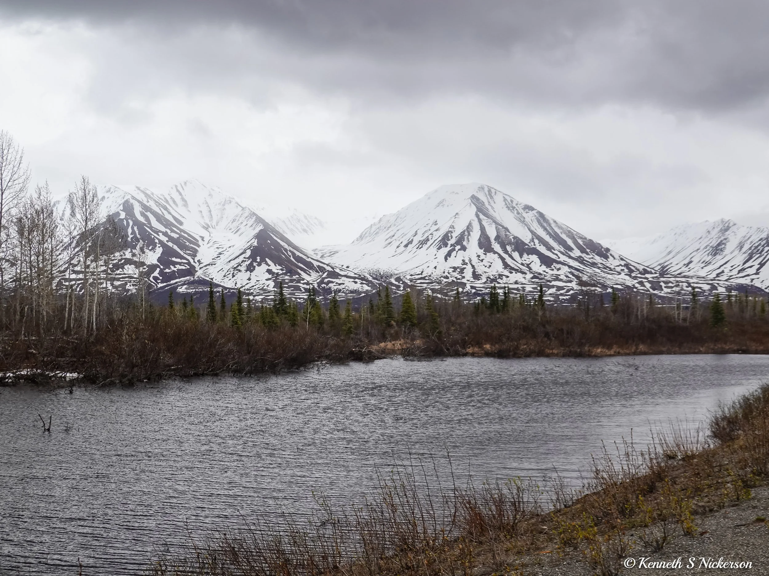
The temperature was in the upper 40s, but the air was raw. It occasionally sprinkled a bit, but the rain was never meaningful. Here a bit of rain was coming down to the left, but the sun was lighting up parts of the mountains. Enough light was fighting through the clouds we I was so that the trees just in front of me popped out of the landscape just a bit.

The photo above was taken just 2 miles after we started. I know this because the small green sign in the distance on the right shows mile 164. Greg, our guide who drives the support van, would tell us where the next stop would be by giving us the mile marker number. For example, where I am staying tonight is just before mile 224. Since we started at mile 162, that means I cycled about 62 miles today.

Our first rest stop was just after crossing over this river. This is looking upstream to the right which should be mostly east.

While this is looking downstream to the left or mostly west.

This is looking north. Much of the first 39 miles were uphill. The grade was never steeper than perhaps 5%. Long uphills were followed by shorter downhills and false flats, so the net effect was generally climbing until we reached Broad Pass.

On the flats, there were often small ponds or little lakes. Here the road bent around to the right which is why it is visible down below by the lake. There is only one road. I am used to having navigation routes loaded in my bike computer which shows the upcoming turns and will tell you if you are off route. When there are no turns, there is really no need.

As the day progressed, the bits of occasional rain stopped and the air felt a bit less raw.
However, low clouds would roll though so more rain always felt possible.

Since I take most of my cycling photos without stopping using a compact camera in my top tube bag, I rarely end up taking selfies. However, here is one of the rare cases when I have taken one. This was shortly before reaching the top of the pass. From the pass, the final 23 miles were generally slightly downhill with a tailwind, so I was able to average over 20 mph for the last hour.
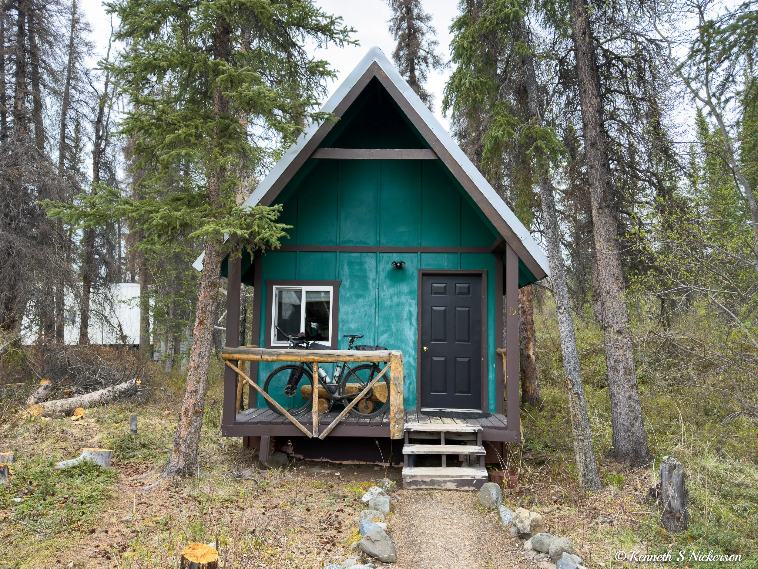
I am writing today’s post from inside this little cabin which is my accommodation for tonight. I will try and post each night of the ride, but I do not know what internet access I will have at each location. So if I miss a night, it is likely because I do not have good connectivity.